(732) 270-9690
(732) 270-9690
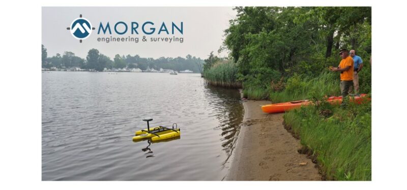
Morgan Engineering Survey Team Uses USV Technology to Elevate Waterway Surveying
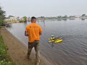
Instead of putting a large crewed boat into shallow or tricky stretches of water, this remote-controlled vessel glides seamlessly across the surface while collecting continuous data. The compact size of a USV (Unmanned Surface Vessel) allows Morgan Engineering to access tight spots along the shoreline, bulkheads, and shallow spots that traditional boats can’t reach, ensuring the survey covers every necessary square foot without disturbing local marine traffic or habitats.
Bridging Land and Water to Define Property Boundaries
Mapping waterfront property lines presents a unique challenge, as traditional land surveys stop right where the water begins. To accurately locate property boundaries that extend toward or into the water for a client in Toms River, New Jersey, the Morgan Engineering survey team combined land-based positioning with advanced hydrographic tools. Using RTK-GPS (Real-Time Kinematic GPS) for centimeter-level accuracy, the team deployed a USV to perform bathymetric mapping along the riverbed. By seamlessly tying underwater topography and depth measurements back to the client’s terrestrial property markers, Morgan Engineering delivered a precise, complete boundary profile—ensuring the client knows exactly where their property lines rest on both land and water.
WATCH Morgan Engineering’s Survey Team on the Toms River
 |
Pinpoint Precision with RTK-GPS Integration What makes this bathymetric survey stand out is the integration of RTK-GPS technology. While standard GPS can have a margin of error of several feet, RTK-GPS uses land-based reference stations to correct satellite positioning in real time, locking down coordinates to centimeter-level accuracy. By pairing this pinpoint location data with the depth readings gathered by the USV, Morgan Engineering can produce pinpoint accuracy of its client’s property lines AND high-resolution 3D models of the Toms River floor – delivering the precise elevation data required for coastal infrastructure, dredging projects, and environmental planning. |
| If you have wetlands or waterway that needs to be measured in any form, contact Morgan Engineering LLC and its Survey Team today. | 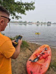 |